|
Penang Hills and Trails - Bukit Elvira Loop 2018 |
|||||||||||||||||||||||||||||||||||||||||||||||||||||||||||||||||||||||||||||||||||||
|
This is one of a series of pages on walking the hills of Penang, click here for the index. This is a long Grade 3 walk. There is a sketch map at the bottom showing the route followed. Please visit my Penang buses page for information on accessing the starting point. This account is linked from my Penang Peaks page which lists peaks over 300 metres as well as other places of interest and viewpoints. To find other hikes which visit this peak please check the maps of this are using this link. We repeated this hike in March 2020, throwing in the side trip up Batu Itam as part of a project to 'bag' the significant peaks on the island. As for the rest of the hike, all the paths described below were in good condition including the steps through the ginger which we had again cut earlier in our visit, in fact this was the fourth time we had come this way although I didn't bother to write a report for any. (All this 15th March 2020) Some six years ago, we first encountered Penang's 'Road to Nowhere' that runs between the twin peaks which are Bukit Elvira. On that occasion, a chance meeting elicited sufficient information for us to complete the journey from Air Itam to Balik Pulau. Yuehong has been nagging me for a 'really long walk' to demonstrate her new found total fitness. I have resisted because her knee is anything but perfect, but she seems to have learned to nurse it carefully and today's walk was entirely on known routes and most of it we had covered during other walks this trip. The only uncertainty was the condition of the steps on the vital link section up which were reported to be overgrown. However, two days earlier we had mounted a survey expedition there and cut back the ginger such that they were almost completely clear as you can see below. It was two days after Christmas but since we are old enough not to overdo the occasion, that was irrelevant. We drove Mavis to the Catholic Cemetery outside Balik Pulau, I suggested going further but was overruled. Officially it was because it was a convenient place to change after but I knew it was because it would mean an extra easy km or two for her 'app'. We weren't quite as early as planned because it had been raining but it had cleared just before we were ready to go. Unlike the better known parallel road to Air Itam this one sees no 4 wheel traffic and very few motorcycles. It certainly doesn't see many hikers as one lady on a motorcycle returned my smile and wave and promptly fell off! I helped her pick things up and off she went none the worse.
This road served to warm us up for the stiff climb ahead up the zig-zags. Fortunately, it was still overcast as there is no shade for quite a way. Soon we got to the point where we were to rejoin this road later. There was a landslide here a year ago, quite what is the benefit of fitting rubber tyres round the concrete columns is a mystery.
At the electricity sub-station we joined the route from Jalan Chai. While we were here, I took the opportunity to check the Penang Rainforest Hash Challenge route for the promised clean up. Yuehong said it would be 'a miracle' but it's not just in Bethlehem that miracles are celebrated at this time of year. I went 200 metres in and found just one piece of paper in a plastic sleeve (on tree, left) where before there had been dozens. I slipped it in my pocket and made a note to send an email of appreciation. If the Hash can tidy up after a mega event, why can't others?
Yuehong had gone ahead and I caught her up near the end of the road. The path to the right leads down to a stream and no further, beyond it is virgin jungle still.
We knew to slip open the gate and turn left up the small sealed path which winds up to the right and soon becomes sandy. The owners obviously come regularly so we advise avoiding weekends and holidays if possible.
Very soon, we vanished through the hole into the 'forest' which is of course yet another abandoned rubber estate. The path is easy to follow and is paralleled by water pipes which must be followed.
The pipes soon branch off into a slightly overgrown area, but it's easy enough to follow them through it, and when the old rubber reappears in front, we knew to turn left and then quickly right where the path resumes.
Beyond the water barrel, at times the path is 'covered' but as long as we could follow the pipes we knew we would be OK.
Parts are quite clear and the small landslide is not an issue.
There are small trees down on the next part which are easily skirted but we knew to get back to the pipes quickly as they are part buried now in places. Soon there is a flat area to the right and just below, if you look carefully you can see the red roof of an abandoned hut (not in this picture). The pipes only go another 50 metres and if you miss the turn then you will see this tree across them and come back.
We've been here when it was a lot clearer and knew the path went through these small gingers and then climbed on stones for a few metres to a terrace.
Behind me and currently inaccessible is the abandoned hut, Yuehong is emerging from the ginger, she knew what to expect because two days earlier we had spent more than half an hour clearing these steps on the left which were covered in gingers and a few vines.
It's not perfect but it will certainly suffice for the rest of this trip (I have at least one more walk planned up here). With any luck, much of the debris we left will wash away in the rains. I would have liked a 'before' picture but these days, I have learned that I can't wield a camera at the same time as secateurs and so on that occasion I had deliberately left the camera at home..
If you are coming in the opposite direction, this is what it looks. You could easily miss the turning off the road we had emerged on. It gives a fair impression of being totally abandoned except that the spraying equipment is in use and two days ago there was a brand new wheelbarrow parked here. As planned, this first section had taken us 1½ hours.
It had retreated to the 'walk through' shelter although there was nobody here today. The hillside is dotted with small bungalows as the site was intended as a Buddhist retreat.
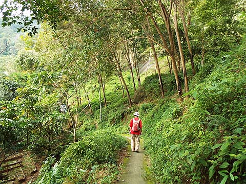
The road has no camber which means water trickles all the way down it and much is covered in a near invisible slippery slime. We advise strongly against coming down this way at the moment, going up we walked on the part overgrown side of it. The road zig-zags to gain height and we passed a second bungalow.
On a clear day, there are views towards Balik Pulau and Pulau Betong but today it was hazy. It took us half an hour to get to the shrine where we entered the forest reserve. Wisely, someone has put a locked chain across the road because there are people who bring their motor vehicles up here to explore and they would get into a lot of trouble if they tried to go down - in places there are small landslides part way across the road and reversing back up would be an 'interesting' challenge!
From this point. it is a relatively easy hike up from behind the shrine to the peak of Batu Itam (ca 721 metres). We did this in March 2020, the pictures below give some idea of what is involved, there is no obvious 'summit' just a flat area covered in vegetation. It is well worth noting a few landmarks going up as wandering off the correct line coming down could land you in trouble - the target area is only a few metres across. It takes 15-20 minutes in each direction if you go at our modest speed. Technically the side trip is a Grade 4 hike but it's nothing like as challenging as most.
The road continued to climb until we reached the highest point of the route, not too far below the summit of Bukit Elvira, a steep and inadvisable transit on the right side. It then undulates slightly.
If you fancy visiting the summit of Bukit Elvira itself, then this is the path up on the left. As far as Rain Gauge 31 (RG 31) it's not too bad but by all accounts the rest is quite overgrown at the moment (you can read about my 2016 visit). Another half an hour brought us to the 5-way junction (Iron Cross to the mountains bikers). This is in effect the middle point of Penang, from here you can reach anywhere if you have enough time but today we would take the small path just to the left of Yuehong.
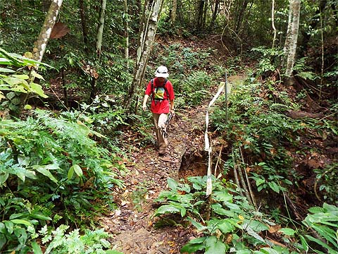
This is a simply wonderful 4 km jungle stroll which had been allowed to steadily deteriorate until it was effectively rendered unusable in the Great Storm of November 2017. I had spotted that it was included in the 'Ultimate Trails of Penang' event in September 2018 which strongly suggested that someone had 'done a job' on it and this was confirmed to me by Peter van der Lans. In fact, we had walked it a few weeks ago in an unreported walk from the Air Itam Dam. It's not perfect (and still definitely off limits to mountain bikes) but with care it's almost back to its former glory. This landslide was marked by plastic tape.
There are several streams to cross and each and every bridge needs care. Some people with a chain saw have been down here.
Another bridge and the fallen tree could be used as a banister by anyone nervous about rotten wood. After half an hour we came to the major landslide, where the path had been cut.
It's in two sections, but it's easy to go up and down and then up and down again.
Each time we met a tree down, we had to assess as to whether to go over or under it, with that large branch, the bags went through separately.
Another bridge, another solution. We had snipped here and there last time, but the secateurs were away today and when Yuehong was offended by a 'wait-a-while' fern she just beat it into submission with her stick.
We got to the zig-zag knowing that there was a significant obstruction at the bottom. This meant climbing a little and for Yuehong this represented an opportunity to sit comfortably and top up with water.
Afterwards, she nimbly made her way along the woodwork and back down to the path. I fear she was far too pleased with herself for this manoeuvre because shortly after she ducked under a tree and failed to notice the remains of a branch which she tried to clear unsuccessfully by barging it with her shoulder. Ouch!
There's a nice small waterfall here and then another oddball bridge.
The farmers on the cleared hills beyond have laid in pipes to abstract water (illegally of course, no doubt some PBA workers were paid to turn a blind eye). Not that the authorities need to worry too much, nature has ways of dealing with this, the pipes are not strong enough to resist a falling tree, you can see one is leaking furiously too.
This is an unusual growth on a very small tree, I assume it's parasitic and we knew when we got to this bridge that there wasn't far to go.
Above us we could hear an unholy racket which sounded like a typical group of enthusiastic youngsters out for a hike. In fact it was mature hikers, who had to shout as two of them (70 and 80) are near stone death, we had met them on this route twice recently as they come here almost every afternoon. If you want to go in the opposite direction then the turning is not obvious, the electricity pole is HT NH 2 21.
We turned right towards the 'Temple with the View' (Bao Tian Gong), Yuehong showed her contempt for the road by taking the opportunity to remove grass seeds from her gloves as we climbed. Which probably explains why it was I who spotted these two interesting rare specimens. I am getting quite good at spotting clove trees and these are in better shape than most although I always make a point of checking the leaves for their 'oil of cloves' smell!
Business was quiet at the temple, we had scheduled a half hour rest here for Yuehong's knee and as a token of appreciation I was allowed a triple Tiger day with two cans here. The sign is advertising their next public lunch, I know this and all I have to look for is the date at the bottom right - 25th February 2019. See you (nearly) all then - there are pictures of previous events here and here, also an even better one at another temple in the hills here.
I knew this time not to let the beer go to my head on the steep descent, my grazed elbow from 3 weeks ago has finally healed up. We went out from the temple and turned left down the concrete path.
The best way is to take the first right into the rubber.
At the hut, we needed to turn sharp left immediately afterwards.
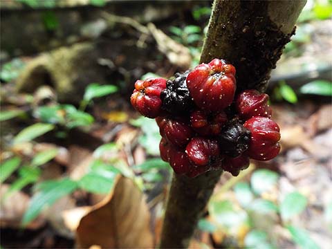
This is one of the few places on the island with current rubber tapping and our timing was absolutely perfect...
We entered a durian orchard which is 'under development', to the right it's looking pretty good but the part we went through is really too steep for fruit trees It was all rubber until a few years ago, of course. That's our road out on the left in the second picture.
We climbed up the other side into old but maintained rubber and rejoined our outbound path to the cemetery.
We'd been out for 7 hours (6 hours net) and Yuehong was overjoyed that we had had covered 14 km. We both felt very good but next day her other knee complained bitterly when she asked it to go downhill. My problem was again my memory, for the third or fourth time (I forget how many, naturally) I put down my secateurs and forgot to pick them up, that's an extra 1 hour hike to get them, I know exactly where they are... Anyway, this is a cracking walk with a lovely mixture of everything Penang hiking has to offer, the 'new' Yuehong didn't even complain about the leeches on the rain forest path...
|