|
Penang Hills and Trails |
||||||||||||||||||||||||||||||||||||||||||||||||||||
|
This is one of a series of pages on walking the hills of Penang, click here for the index. This is a Grade 3 walk. There is a sketch map at the bottom showing the route followed. A year ago, I was lured to the Bukit Mertajam area by tales of railway relics around Bukit Seraya. Now it was time to climb the adjacent main hill, at 545 metres it is is slightly higher than Bukit Batu Itam in Penang's National Park. The inspiration for this hike was the slim volume 'Nature Trails of Seberang Prai' by Rexy Prakash Chacko, ISBN 978-967-5719-36-4, published in 2019 by Areca Books, www.arecabooks.com, available locally and through the website for MYR 20. It has good coverage of the routes used in today's hike. There is a 'tarred road' all the way to the top which we did our best to avoid, its course is shown in white on the map. We parked up near the entrance of the Bukit Mertajam Recreational Forest in Jalan Kolam - the sign for the turn off being almost invisible and enveloped by a bush, but most visitors wouldn't need it, foreign tourists don't come here. It was a Tuesday, so there were far fewer visitors than on our first visit (a Saturday). We were taken under the wing of Awal a local hiker and 'Old Free' who seemed concerned we would get lost in the forest. He guided us up past the abandoned Cherok To' kun Dam built in colonial times in 1939. We started up the stone steps, the origins of which were not immediately apparent.
The path eased and then there appeared a familiar and unmistakable sight, this was surely what we call a 'Hakka Wall' although unlike on the island of Penang, these stones, and those on the path, were not rounded.
Soon we arrived at Rest Shed 1. Next door is a famous waterfall, but in the present dry spell it was quite simply pathetic as a spectacle. The blue board was a standard local catchment area one.
We continued up the steps through the terraces and the arrived at Rest Shed 2.
Awal left us here, he had 'business' to do and he had never been on the next section which was off to the left on one of the former rubber terraces. He would go straight up where he would soon join the 'tarred road' up, there being another connection to the right. I think by now he had worked out that we could look after ourselves.
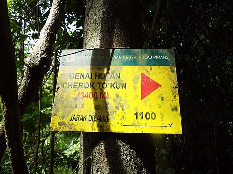
Up to this point we had seen several walkers but from here on to the summit there were no more, excellent! The steps continued and some of the Forestry Department's signs were still present and attached to trees.
Some hikers had attached some whacky appendages to a boulder and we paused at what was possibly the last wall.
We knew what would happen next. Invariably, the forest trees that try to occupy the transition area which is the top terraces struggle and as a result they tend to fall whenever there is a storm. It's something we've seen in many places on the island. Necessarily we said 'Goodbye' to the stone steps and climbed on.
The last significant point is known as Station 1 for some reason and a couple of red plastic chairs had been provided for weary old men (and women). Just above was a junction, we could read 'Top' to the left and whatever it said for the right would have just have gone to the tarred road.
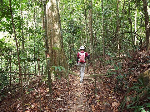
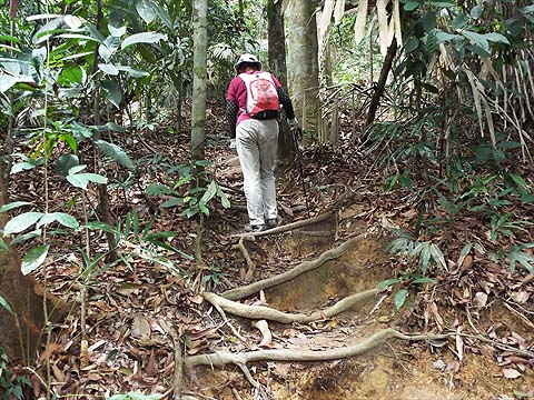
This was now true forest and there were some very nice trees here. Unfortunately, the steps were now based on tree roots which is always sub-optimal.
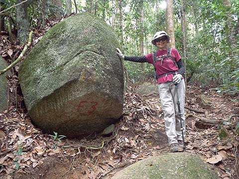
The F3 sign appears in a number of places on the island, usually on serious trails including that on the climb from Air Itam Dam to Rain Gauges 28 and 29 and again between Pantai Mas and Bukit Batu Itam in the National Park. Although overcast, it was warm and humid and I had to wait for Yuehong as we approached the end of the climb.
With a hole in the fence, it seems this first mast is redundant and there was no sound from it. We went along the fence where the found the tarred road coming up as expected. This is yet another hill in Malaysia where you can't quite manage the top, but at least there were no armed soldiers here.
This was not the place for a break and even though someone had donated some chairs round the corner we kept going and started down. I have no reason to doubt that this gentleman had made it all the way up, he gave his age as 'over 80'. Our immediate destination was not far down to where a viewing platform has been erected.
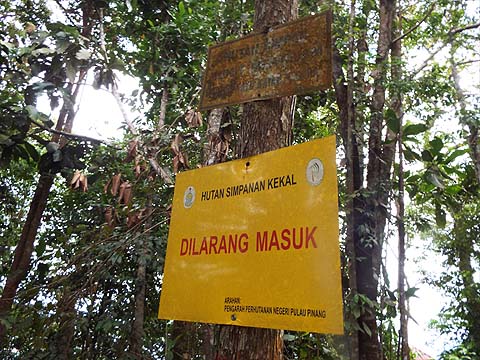
Old and new yellow signs are present, I'm not sure why as I would have assumed the whole hill was a designated reserve. Unlike the biodegradable platform erected at the summit of Bukit Laksamana, this one is made of concrete and ought to be around for some years to come. I believe that's Bukit Seraya (429 metres) behind Yuehong.
The main attraction here is the view of the recently expanded Mengkuang Dam. Although if collects some water from the hills, its main use is to serve as a storage reservoir for water taken from the Sungai Muda (River) to the north which forms the boundary between Penang State and Kedah. As such some 80% of the state's water comes from here. At the moment it's just under 75% full which is good news given the extended dry spell which has near emptied the next largest Teluk Bahang Dam and it's months till we can expect more than the odd shower.
We were treated to another Mengkuang view and the site of numerous plastic covered (and unrepaired) landslides presumably dating from the Great Storm of November 2017 which made such a mess of the main hill (Bukit Bendera) on the island. I guess they'll have a long wait before anything is actually done here, they still haven't finished on the island.
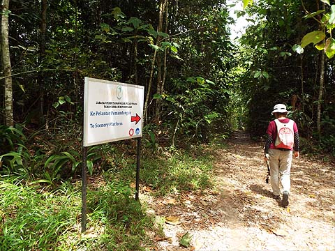
This is known as Pondok Recreasi and is a popular stopping off point for hikers. Behind the blue sign was our forest trail down.
Initially this followed the ridge between two peaks. It was a long time since we had seen one of these signs and as this one was propped up on the ground, I guess it will soon be taken as a souvenir. Certainly until money is found for a fresh set of signs nothing will be done about putting it back, there is no word for 'maintenance' in Bahasa Malaysia.
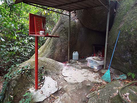
This trail attracts people of all Malaysia's races and there are several Chinese shrines in this area. This Macaque has obviously worked out that it will provide a constant supply of delicious oranges, I would guess that any left here would have a half life of well under 5 minutes.
We were soon back into the transition area and the trees were down in numbers again. As we approached Station 2, we could see the last remaining Hakka stones. I always understood that fires in the forest were forbidden but here some offcuts were being burned instead of being left to rot naturally.
It is an unfortunate fact that the vast majority of those people who profess to be nature lovers and hike here have absolutely no idea of what is necessary to keep a path healthy. The shear weight of numbers coming this way would make it very difficult to maintain it but in fact it's quite obvious that misguided 'do gooders' are sweeping the leaves off the path where a good covering of 'leaf litter' is the best protection going against erosion. Look how the original stone steps have been left isolated, they won't last much longer like this.
We had a further diversion to the left, clearly signposted to Big Tree and Old Dam. The local council are promoting a programme of Forest Bathing, but with the present level of the stream near here, there won't be many takers.
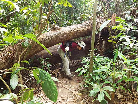
We'd come to see the famous 'Big Tree' and while it wasn't too far away, there was a rope assisted climb and a couple of fallen trees to negotiate.
It's a Tetrameles nudiflora, the only species in its genus Tetrameles and together with Octomeles sumatrana comprise the only two species in the family Tetrameles. Never mind the science, it's simply magnificent and towers into the sky above. I was concerned at the absence of leaves on it but it turns out that it is deciduous and drops its leaves during the dry season. The lumps of greenery on it are, of course, epiphytic ferns, these trees often have suitable natural hollows in their trunks. It is found across South and South East Asia and into north Queensland (Cape York Peninsular). (This information comes from Wikipedia of course.)
Back on the main path, we were on the last stage of our hike.
We saw these red flowers in a couple of places from tress growing near the base of the hill. Rexy tells me that they are probably from the Asam Gelugur tree, the fruit of which is widely used in Malay cooking. It has medicinal value as an anti inflammatory and, perhaps more important today, to reduce high blood pressure and lower cholesterol levels. This bridge had received a direct hit from a falling tree some time back but like the hill slopes above, a repair seems to have a low priority. Why should State Forestry Department employees leave their cosy air-conditioned offices for such a mundane task?
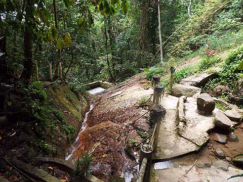
These concrete steps at least are in good condition and will offer some relief to the original path on the right. The picture on the right shows what seems to be (or maybe was) an official abstraction point for water. These days most of it must be vanishing down the pipes to God knows where.
We'd had an enjoyable hike and were soon back at the car park. The area is a vital 'green lung' for what is generally perhaps the least attractive part of Penang State. However, on the evidence of what we had seen, it is not being managed in a sustainable manner, in fact I saw no evidence it is being managed at all. The map below is a trace from Yuehong's App 'Pacer'. The white lines are the rest of the 'Tarred Road' up the hill. As you can see we went round the loop in a clockwise direction.
|