|
Penang Hills and Trails - National Park Madness, 2020 |
|||||||||||||||||||||||
|
This is part of a series of pages on walking the hills of Penang. Click here for the index. This is a Grade 4 walk. There is a sketch map at the bottom showing the route followed. Please visit my Penang buses page for information on accessing the starting point. This account is linked from my Penang Peaks page which lists peaks over 400 metres as well as other places of interest and viewpoints. To find other hikes which visit this peak please check the maps of this are using this link. After almost 4 months of hiking in Penang, we felt we were fit enough and experienced enough to go 'anywhere' or put another way, we could 'walk on water'. Today we were convincingly proved wrong. The idea, courtesy of friend Rexy, was to first climb Bukit Telaga Batu in Penang's National Park which at a mere 335 metres (1120 feet) would leave us plenty of time for some serious exploration afterwards. We were joined by Peter van der Lans and since none of us had been in this area before it would surely offer a 'challenge'. There was no point in recording the first part as we headed up the notorious Pantai Kerachut path to its high point where the Bukit Batu Itam path starts. We were to go in the opposite direction...
There were two trails available, we chose the left one which looked better used. We'd done several lesser paths on the (western) Pantai Mas side of the National Park and surely this one with a shorter climb would hold no terrors?
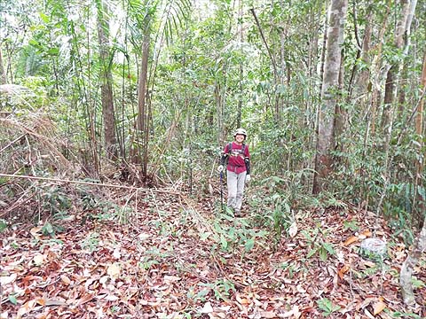
Up we went, it seemed that as has often happened in Penang, the original path has become an overgrown 'gully' which necessitated frequent switching from one side to another. Never mind, there were signs that other serious hikers had been this way too.
Parts of it were clear too and everyone was happy to pose for the camera.
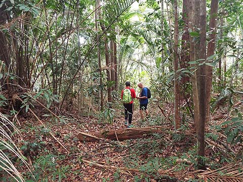
More signs and in less than an hour from the junction we were on the summit ridge. Now the easy thing would have been to turn right and head down to Tanjung Duyong, a path that is marked on more than one old map and still seemed to be present. If you want to read about that rather than the horrors to come on this walk, then click here.
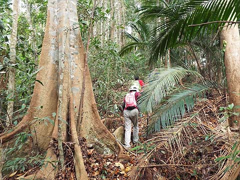
That would have been too easy, so having ticked off the two minor peaks at the end of the ridge, we went back and headed for the main peak. However, if you want to learn about the path on the right which leads to Tanjung Duyong on the coast, please click here.
This was definitely not a popular option, the ridge was anything but clear. The path was under the vegetation and this fallen tree was a sensible option. When we had cleared the dip, I quickly found the path again and Yuehong showed her appreciation.
Up we went and soon we were at the true summit. It was time for a 'pow wow'. In fact there was no disagreement, we would try to find a ridge down which would take us to the route between Teluk Duyong (universally known as 'Monkey Beach') and Teluk Ketapang, which would be roughly in the direction of the elevated Muka Head lighthouse from where we were.
The direction was agreed and we made a good start when Yuehong spotted a marker.
Keeping to the plan was another matter because 'nature' had other ideas. With trees down on the ridge we were consistently pushed to the left. No one in their right mind would go through that kind of rubbish. When I realised that I needed to slide some 20 metres on my bottom I put the camera away. In retrospect that was one of the high points of the descent.
What happened next? Initially the Apps showed that we were following the agreed ridge downward. What the Apps couldn't tell us was that not only were there more multiple blockages but that the lower parts were covered in the most objectionable prickly vegetation I have ever experienced on a Penang hike, in fact it just about destroyed my hiking trousers. We got quite close to Teluk Ketapang but were beaten back. We tried to make it to the valley which connects that beach with 'Monkey Beach' but found ourselves in a 'sea of boulders'. So we had to go up slightly again to make any progress. Yuehong had done her share of leading and was pottering along at the back when she spotted this Wagler's pit viper in a tree. Long ago I remember spotting one similarly while returning down a path I had used earlier, now I had missed another one. Yuehong didn't ask it to move to a more photogenic position, after all they are (mildly for humans) venomous. She says the left end is the head...
Again we retreated up the hill and then we cut our way round until we could see the durian orchard below which is known to be behind Monkey Beach. 4 hours after I took the previous photograph I got the camera out again to record the moment. Yes, I could have taken more pictures but what purpose would it have served, for much of the time seeing even 10 metres ahead would have been a luxury.
I confess that we succumbed to a sensible offer to pay for a return to base in a tourist boat. We were exhausted and out of water. It was, in the circumstances, a very wise decision. In all our years of hiking in Penang, I have never before been so tired that I failed to make it for dinner. It would have been against my religion to skip the Tiger too, after all I was seriously dehydrated. We shall go back, of course, but only to complete the 'soft option' to descend to Tanjung Duyong. At the moment the coastal path from the park entrance to the Monkey Beach has been closed for some time, apparently there has been a landslide. I wouldn't trust the opinion of a National Park employee as to which side of Tanjung Duyong it is. The National Park management seem to be in no hurry to sort it and the boatmen are making a small fortune, in today's Malaysia you might wonder if the two were connected.
|