|
Penang Hills and Trails - Bayan Lepas Lollypop |
|||||||||||||||||||||||||||||||||||
|
This is part of a series of pages on walking the hills of Penang. Click here for the index. This is a Grade 2 walk. There is a sketch map at the bottom showing the route followed. Please visit my Penang buses page for information on accessing the starting point. The starting area has changed significantly since this report was written, half of the centre of Bayan Lepas has been torn down and a new multi-storey condo has appeared. I recommend going up Persiaran Kelicap (served by a 302 bus), walking to the end of Lengkuk Kelicap and turning right just after the new condo which will bring you to the ascent. Click here for the full report. This account is linked from my Penang Peaks page which lists peaks over 400 metres as well as other places of interest and viewpoints. To find other hikes which visit this peak please check the maps of this are using this link. By 2023 access between the two orchards on Bukit Papan was blocked, it's a shame as it has been a very useful transit in the past. A few days earlier, we had tried and failed to find the route
to the viewpoint above Teluk Kumbar shown on
We had a standard early start for the south of island with breakfast at home, a second breakfast in Teluk Bahang and PHH 4498 on the 09.45 501 service to Balik Pulau (note since then the bus has been retimed, see above). We picked up some steam buns for snacks and took the 401 over to Bayan Lepas where we alighted near the Police Station ("220" in the map above). We walked up the road towards Kampung Perlis and turned left at the next junction opposite the mosque. Our trail was the small Jalan Kampung on the right side.
I was somewhat put off when the '4 wheel trail' turned sharp left as the pictures clearly indicated that we would be following a wide trail for some way. It didn't take long to follow it to its 'doggy' conclusion and come back to try the narrower trail instead. Very soon we came to a 4 way junction which, quite honestly didn't quite look like that on the map above. Ahead was a nice path albeit in the wrong direction, to the right was a a road heading up towards a block of flats but more importantly to the left was a concrete road that looked just what we wanted. We needed no second invitation...
There was quite heavy traffic and along the trail were shacks which politely might have been called 'cottage industry' but were in fact 'small factories' in all but name and surrounded by their waste, mainly plastic.
Over the top of the bushes, we could just see down to the modern Sungai Ara, compared to what we saw later, this view is flattering in the extreme. Soon all that was behind us and ahead lay a small shrine which we recognised from the trail description.
The next junction offered 'roads' left and right. but the latter when checked went only a short way to a few houses. We continued up to the next junction, where the 4 wheel trail went right and a narrower path headed in the direction we wanted. This was basically through old rubber although we could see a durian estate to our right.
We ignored the concrete path on the left and headed on, the next left we checked but it quickly came to a dead end by an abandoned hut.
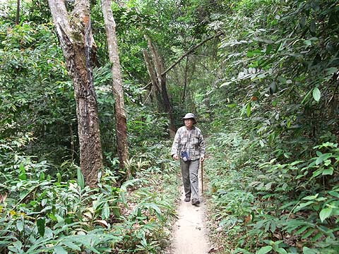
It was a very pleasant climb on a path which was in good condition albeit not heavily used. We ignored a right fork which appeared to go down to a vegetable garden and just as suggested the path eventually turned sharp left.
It continued along the contour and again, as indicated, we soon came to a small junction where the right fork would lead to the ridge. We should previously have approached this from the other path and had we come down the same way we would have checked it out. As it is, it is on the 'wish list' to solve our curiosity as to where we had gone wrong previously at the other end of it.
We had climbed a long way now but none of it had been demanding. In almost no time we were at the ridge where the top of the hill had been largely and recently cleared.
One result of the clearance was that there were first class views. To the east showing first the airport and Pulau Jerejak and secondly the new Penang Bridge under construction:
On the other side we could see first Teluk Kumbar, the Gertak Sanggul Peninsula and Pulau Kendi and then Bukit Genting.
Spectacular stuff, far better than the trail report suggested and more than making up for the limited view we had obtained previously from not so far away. The far end of this plantation was overgrown, but just beyond I could see what looked like the 'hut' we had seen from down below on the west side. The scrub was just 3 metres and a small ditch wide and we scrambled through, it was yet another of the bird's nest factories. By 2023 access between the two orchards on Bukit Papan was blocked, it's a shame as it has been a very useful transit in the past.
It was surrounded by coconut palms and I realised that this must be the destination of a walk I had read on the web, http://rexymizrah.wordpress.com/2013/01/12/hikesungai-ara-to-bukit-papan/, I had assumed he had used the same path as we had come up, but now it was clear that we actually had an alternative route down. If you read his interesting account you will see that he was more than a bit wrong about the views. Soon we were into durian country.
The recent availability of a pool of cheap labour has meant that plantations on the island are now being worked again, these rubber tappers were working 'old' rubber next to some trees which were just a few years old. The road carried on down as a mixture of laterite and concrete and we came to a gate which looks as if it has not been shut for quite some time.
There were other paths left and right but we had no time to investigate - I realised later that one to the left was probably that down to the wooden house in the Sungai Ara valley above Jalan Kenari which I had seen on EveryTrail. We just headed on down into an area which has been brutally cleared, possibly initially for bananas. It is not a pretty sight, neither is the nearby bird's nest factory, this view seriously understates its huge ugly appearance.
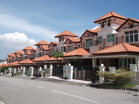
This had been an open descent and we were both feeling the heat, fortunately we were now into a shaded section and in almost no time we were back where we had left the 4 wheeled trail some hours earlier. So it had turned out to be a 'Lollypop Hike' and we now had to retrace our steps down the stick part. When we got to the back of the flats, we made our first bad decision of the day, namely to go out the same way that the cars and trucks did from today's hill. Close up the government flats are quickly going tatty, not as bad as the Paya Terubong ones but just give them time. Round the corner in Persiaran Kelicap, it was impossible to realise that not so long ago this area had been as green as the hill behind. The Setia Pearl Island Condo is simply out of all proportion for the environment and opposite is a place that reminded me of the nightclubs for the over-moneyed elite I used to see in China. Finally there was a set of houses which looked like they had been designed by a 10 year old with a job lot of Lego bricks.
I reminded Yuehong of our resolution not to go home from our walks via George Town unless there was no practical alternative. So we jumped on the first 302 bus down to Bayan Lepas and transferred to a 401 bus to Balik Pulau. Half an hour later we were in our regular coffee shop there enjoying an early dinner and appropriate liquid refreshment, sanity had been restored. PHH 4498 was 20 minutes late on the 17.30 501 service as it always is but we were still safely home by just after 19.00, well before it got dark. It had been a very satisfying day out, leaving just one or two loose ends in this part of Sungai Ara / Bayan Lepas to be sorted on another visit as time allows.
|