|
Penang Hills and Trails - The Balik Pulau
Hills |
|||||||||||||||||||||||||||||||||||||||
|
This is one of a series of pages on walking the hills of Penang, click here for the index. This is a Grade 2 walk. There is a sketch map at the bottom showing the route followed. Please visit my Penang buses page for information on accessing the starting point. For other visits to Nibbinda, please read Nibbinda Circular, Nibbinda Direct and the Balik Pulau Explorer 7. This account is linked from my Penang Peaks page which lists peaks over 400 metres as well as other places of interest and viewpoints. To find other hikes which visit this peak please check the maps of this are using this link. Some time back while searching for suitable walks, I came across
references to the Nibbinda Forest Monastery - From what little information was available it appeared that it might offer no more than a straight up and down walk so I bookmarked it and saved the experience for an occasion when we might need a shorter than average walk. In the event, it turned out to be a very pleasant near full day excursion. We now have a well established routine which sees us leave home just ahead of 09.00 with sufficient time for a leisurely local breakfast in Teluk Bahang before catching the 10.30 501 bus towards Balik Pulau. This occasion was enlivened by bumping into the ex-pat resident who had tipped us off about the Secret Garden route to Pantai Acheh. When we got off the bus in Balik Pulau we headed straight for our regular source of lunchtime buns and then took the road towards the Air Itam Dam (see the Fruit Orchard Trail). Some way after the Catholic Cemetery, there is a small sign for Nibbinda which could easily be missed, it's right opposite a young rubber tree smallholding.:
Dropping down to a bridge across the stream there is immediate confirmation that you are on the right route, but apart from one such similar sign there was no further indication, it was just a question of following what appeared to be the main concrete trail at each junction. It was quite shady, helped by the fact it is a north facing hillside and the sun was still to the south.
There was light traffic, the inevitable motor bikes came up and down but by and large it was just what was needed to get us back into the groove.
The views were totally predictable and familiar, mainly down towards a hazy Balik Pulau and up towards a slightly clearer Bukit Elvira:
Eventually we came to a gate, these days such things are best ignored unless they are closed with the local wolf pack salivating behind. At first sight, it was disconcerting to find that the road seemed to stop at a large house, but never fear, it continued off to the side...
There were now two versions of Plan B apparent. We could later descend to Balik Pulau using a path taking off from the toilets just beyond where Yuehong was standing (this would literally have been a crap decision as it happens) or we could beg a lift down in the monastery minibus. We did hope though to do rather better.
I have to say, frankly, that the monastery was a bit of a disappointment. The well trailed star attraction was no longer in residence, he had apparently bogged off to the US and wasn't expected back anytime soon. All that was left was a rather faded sign:
The view down was indeed splendid and there was some very nice accommodation available.
However, the place was almost deserted, there was apparently a Danish monk in residence but like the monastery's website, much of it was 'under construction'. We left via the rear exit feeling that maybe the principal sponsors should have kept their wallets in their pockets. It led into a young rubber estate where we joined a concrete path.
Ahead of us was the ridge of the Relau Hills but from previous visits we knew that the erstwhile ridge path was probably no more than a few dashes on a very old map and we were looking for an interesting alterative descent. We were on a ridge at right angles to the main ridge, to our left was rubber and to our right where we really wanted to go were fruit orchards beyond intervening steep secondary jungle. Where the young rubber finished there was a water tank and beyond, ahead and to the right, old rubber which was being tapped occasionally. I didn't fancy going up but did fancy following the horizontal level of rubber just below us.
Why? Quite simply there was a mass of half a dozen water pipes which followed it and from experience they would lead to an inhabited area (I learned later that this was 100% wrong in this case as they were bringing water into the tank!). For 5 minutes we carefully wound our way along the hillside and sure enough we came out into a durian estate. Even better we could see another trail, the only problem being that it was some 25 metres below us and being out of season it was a bit overgrown. Never mind - lah, necessity is the mother of all invention:
And two minutes later we were on a fair path and when we joined another clear concrete path we knew we could relax and enjoy a pleasant descent.
Temptation was safely ignored, we've hardly touched a durian since last year's glut totally sated us. From time to time we joined more trails down, but given we were in a side valley below Nibbinda, we knew that if we were to return in the opposite direction we need only keep left (apart from one short spur over a concrete bridge). Of course finding the connecting route back up to the water tank might be a little more challenging!
By now we were in concrete electricity pole country although it would be a while before we would see an inhabited dwelling. There was a mass of beautiful orange flowers on some creeper and at the opposite end of the scale a large burnt area..
Our small valley started to widen as we joined a much larger one with views down to Pulau Betong. It was absolutely first class walking.
Inevitably we came to the point where the concrete trail became suitable for 4 wheeled vehicles and soon after we came upon Balik Pulau's answer to the UK's spaghetti junction - we had entered right and would exit left.
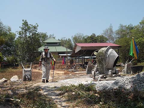
There was a rather large area which had been fenced off, no doubt a mansion would appear here in due course and we saw a couple of trucks ferrying material up - owing to the gradient they were underloaded compared to normal. Maybe there are no planning regulations in this part of the island?
We had already missed the 14.30 501 bus so we sat down and enjoyed the breeze, unfortunately some flying insect took exception to Yuehong's presence. We whacked the iced towels on the bites and the effect was short lived. I noted that we had a nice view of Nibbinda looking back and we marched on down to Balik Pulau.
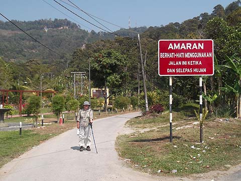
Finding our way back up here will be undemanding, the small road branches left off the Relau Pass road (Jalan Tun Sardon) just after the bus station, after which all you need do is cross the stream and start climbing.
5 minutes later we were outside our regular coffee shop. The gesture indicates that an early dinner had been ordered rather than the Tiger, but the latter was on the table and opened almost as soon as I had sat down and the Sar Hor Fun followed immediately.
It had been a far better walk than I expected even if the monastery had been a disappointment. In the convivial atmosphere, the next 90 minutes till our 17.30 501 bus just flashed past. As planner in chief, I am only as good as my next walk and I confess my list of possibilities and known unknowns is getting shorter and shorter.
|