|
Penang Hills and Trails - The Temple with a
View 2015 |
|||||||||||||||||||||||||||||||||
|
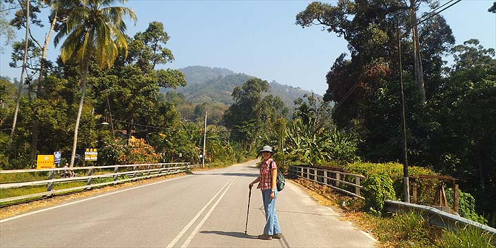
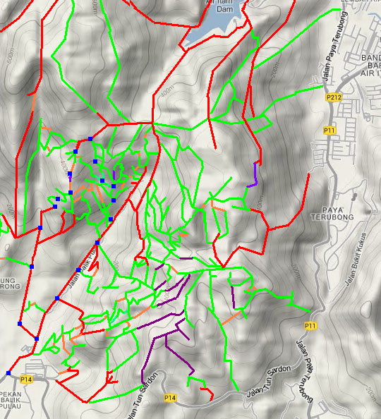
This is one of a series of pages on walking the hills of Penang, click here for the index. This is a Grade 2 walk with elements of Grade 3. There is a sketch map at the bottom showing the route followed. Please visit my Penang buses page for information on accessing the starting point. See also our previous visit in December 2012 and Part 1 which covers the background to this walk. With effect from 2022, the initial climb described here has been blocked by the landowner. While there are other less convenient alternatives, for most people the best route now will be to continue further up the valley and take the new concrete road which rejoins the traditional trail part way up. A description of this is given on another page - the link will open in a new tab.. I had often looked across to 'Bao Tian Gong' on the ridge between the valleys between the Air Itam to Balik Pulau Road and that leading to Bukit Elvira and thought that there must be access from the west side as well as the east side. The previous day we had made a recce of the area, we had found our way up but perhaps not in the most elegant fashion and today we set out to do things in reverse to put things together. The walk as we did it frankly would best be done in reverse again, but since we haven't done that, you'll have to take things as they came. Our target is on the minor peak behind Yuehong who's standing on the Balik Pulau to Air Itam Expressway in the middle of the rush hour.
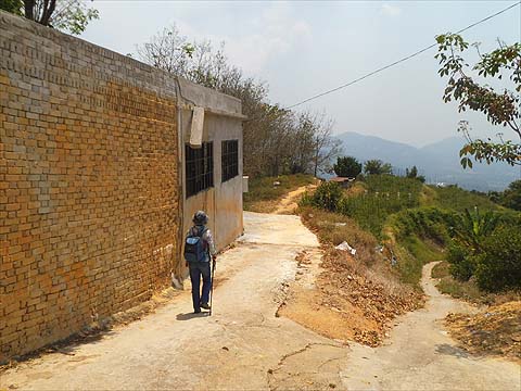
This initial climb is no longer available as from 2022 (see the note above), This time we went up the Air Itam road until we came to our turn off. You can't miss it and as always you can safely ignore the signs. Don't worry, the old tyres are not for 'necklacing' unwanted visitors, they will be used to reinforce the paths. We were asked why we were going this way instead of the 'main road' but when we said it was 'more shady' that was the end of the quiz.
It's a cracking climb, it features gates without fences and a barrier which is 'out of season'.
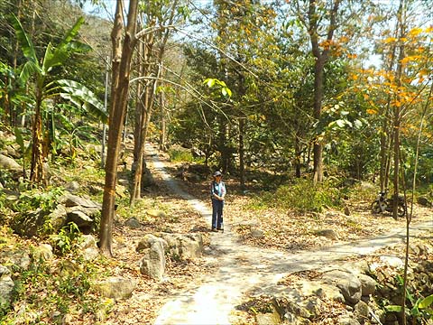
The path above comes to near a house and a U bend is required, the electricity poles appear here and the first one is NH 2 75 2 18 17. Now the 2012 notes say to turn right at the next junction which we did, but frankly if you go left (which is where I had come from the day before) it would have been a better idea. It's that kind of hill, there are paths galore and many meet up again later.
Having gone right we came to this junction (on the left below) and when we tried the main path to the right we found ourselves heading for the local dogs' home which we had passed in 2012 and which I had somehow by-passed the day before. If you see the junction on the right below, the path on the right goes in the wrong direction away from the hill, that on the left is if you want to go to the dogs. So on reflection we went back and up the path on the left in the first picture.
This brought us back to what I recognised as the path I had come down the day before as there was Penang's doziest dog tied up outside the house behind where I was standing. We went straight up behind where Yuehong is. The next junction is critical. If you have ignored our advice and run the gauntlet of the dogs you will come in on the right. Either way upwards, you can turn left or right where Yuehong is standing, but then you will have to turn right or left at the next junction!
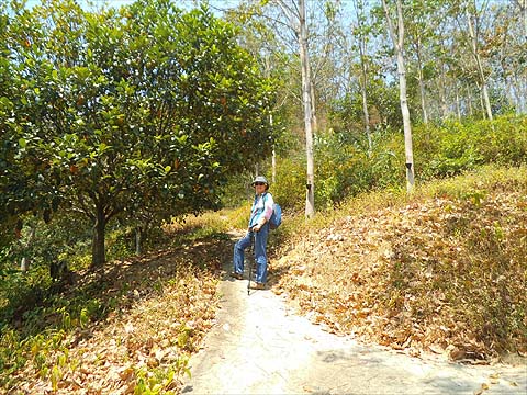
This is where the paths come together again looking down on to the left fork's route. You'll know you've got it right when you come to this electricity pole and the sign which some angry mountain biker or jogger has vandalised.
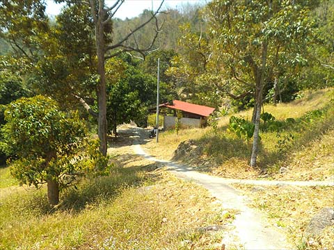
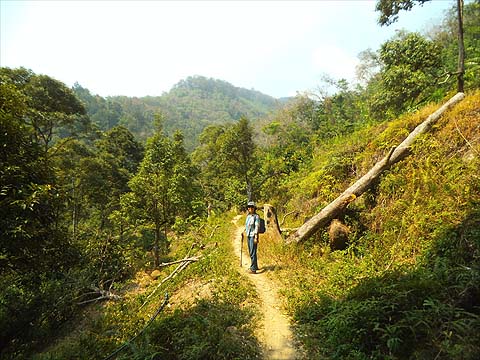
I'd passed this early on my descent the day before so I knew we just had to press on upwards, passing this hut below.
In no time we had reached the road, this time I managed a picture of the sign which can be read. We went along to the temple for our lunch break and found a trickle of regular visitors. It was too hazy to record the view, maybe they are burning the rice stubble on the mainland again.
Now came the serious business of finding our way down, properly. We had been down the path on the right the day before, at the first house we were told that the path beyond had fallen into disuse. So we kept left and entered the dahlia plantation which produces blooms for those ignorant devotees who have no environmental knowledge or conscience.
That's what's needed to produce flowers for a year or two until the land is exhausted and afterwards it will take many years for it to recover. We picked our way to the corner and went into the rubber.
The next section was a classic 'no pain, no gain' experience. Slip sliding down dry rubber terraces is only fun if you are young enough to ski and Yuehong's knees took a real pasting. In fact almost as much as my ears. Never mind that if it had not been for the work of the Burmese above and these terraces, then there would have been no practical way down here, the original paths having long since become overgrown.
By the time we got to the top of the concrete path, things were rather better; it was 50% smile and 50% scowl.
I have to say it was a much needed excellent path, with gentle slopes and curves and occasional flat sections with views of the forest above.
This is the key junction at the bottom if you walk up this way, it's right at the point where the Bukit Elvira road starts to zig-zag up the hillside. It crosses the stream (no path up it!) and then climbs past a house on the right, it's difficult to go wrong as the only other paths are minor.
As we came past the house, a man looked up in amazement. Addressing Yuehong in Mandarin he asked where we had come from. "The temple at the top" she replied. "But there is no road...", "Of course." and we walked on. I'm still not sure he really believed her. If you fancy this walk, they try it in the opposite direction to that described. It's much easier to go up rubber terraces than down and there's then very little chance to get lost on the downhill run from the temple.
|