|
Penang Hills and Trails - Balik Pulau
Horseshoe |
|||||||||||||||||||||||||||||||||||||||||||||||||||||||||||||||||||||||||||||||
|
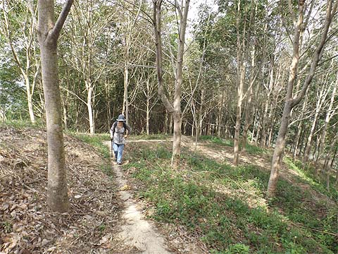
This is one of a series of pages on walking the hills of Penang, click here for the index. This is a long Grade 2 walk. There is a sketch map at the bottom showing the route followed. Please visit my Penang buses page for information on accessing the starting point. This account is linked from my Penang Peaks page which lists peaks over 400 metres as well as other places of interest and viewpoints. To find other hikes which visit this peak please check the maps of this are using this link. In life, there are certain immutable laws. As a former chemist, I learned the first and subsequent laws of thermodynamics. As a man of the world, I have latterly learned that equally important is the law that says that you should not argue with Yuehong. With our return to the UK looming, I planned a walk on the east and west sides above the Balik Pulau to Air Itam road, being my idea of what is the best walk available in this area from our researches. It was to be almost entirely on known sealed paths, with no off-piste hiking at all, it avoided almost totally the Nanshan wastelands, it had splendid views and included a very interesting Chinese temple. A classic of its kind in other words. I even agreed that we would get out of bed at some unearthly hour and catch the 07.50 501 out of Teluk Bahang in case it turned out that my timings were optimistic. So much for the theory, it got me just over half way round as you will read. Please excuse the initial pictures, they are ones I took earlier as we have been up the path concerned several time this year. We started from Balik Pulau before most of the shops were open and turned right past the house at the turn off (pole HT NH 4 88) on the Balik Pulau to Air Itam Road. In my book it's the classiest one in the valley. The owner knows what he is doing and has left many trees and planted many more young ones. As before, we followed the road left and up, ignoring the road with the barrier on the right. We went past two houses climbing what was now a concrete path. The first junction is at a concrete platform, we knew to turn left here as the right path leads only to a small hut beyond which an old man has told us there is no way out.
The next landmark was this ruined house with a huge old durian tree in front of it, it must have been a lovely place once. Behind is a small Chinese shrine of the kind that are dotted all over the southern hills of the island.
We were now in a very well maintained durian estate, instead of taking the valley path straight up, we turned sharp left up the path below (the picture was taken looking back down). .
The path climbed steadily with some splendid views across the valley and back to Balik Pulau and Pulau Betong beyond. The durian trees which were previously preparing to flower were now in full bloom (not shown) and just beyond this one, where the path joins the end point of the concrete road, we turned right along the concrete path.
Soon another path trailed in from the left, we took it, at the point shown in the first picture. We went up to the top of the path and when it finished, we went just to the left of the hut ahead and the path came down to the 5 way junction below.
We took the concrete path to the left with the electricity poles (NH 4 7 46 here) downwards. After passing a house we came to pole NH 4 7 30, the Forest Ang Trail goes right from here, but today we continued on the concrete road until we came to pole NH 4 7 8 where there is a path on the right up the hill and we took this. Do not be tempted to take the earlier right turn, it has yet to be investigated by us. Previously we had come down this path twice, but this was the first time we had been up, we knew it to be quite a long climb. It's a critical junction so we needed to record it from both sides, Yuehong's look said something along the lines of "Do you think the people who try to follow our trails are idiots?"...Only you know the answer to that one.
So it should not be too difficult to ignore the concrete path that trails in almost immediately on the left and enjoy what is a first generation concrete path with easy gradients. There's just one more junction where the path to the left can be safely ignored as the main path continues upwards.
The durians were universally in flower, behind is the 'Temple with the View' where I had planned to enjoy my second Tiger moment. The electricity poles which had followed us up finished as we turned left, of course she knew I would have wanted to take a picture here..
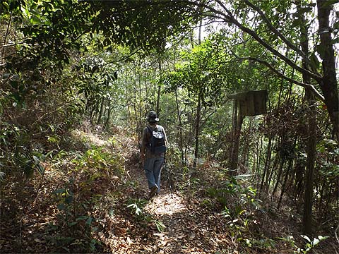
This was now a second generation concrete path and rather steeper, the fact that we had previously joined it from Forest Ang's Trail as shown really was of no interest. At least when we got to the bamboos, the worst of the climb was over and when we turned right at the hut, I got my first smile for a while.
I've included views from this route in previous reports, it offers a constantly changing panorama. The first was our only glimpse of my unfavourite Botanica development. The second looks across to the ridge with the 'Temple with the View'. Dangerously, I commented that we had not previously visited the triangular area to the right of it on another ridge...
Let's just say that there are some athletes who don't look as if they enjoy exercise, I knew from our previous visits, that the never ending upward concrete would soon end and we would be into what continues to the beautiful Nanshan Wastelands. I was glad to see that the message had got through.
For just a couple of minutes we were experiencing Nirvana and then the vegetables came into view.
There's no point in cropping out the foreground, the views show the area for what it is, a monument to environmental ignorance and human greed. Follow the path to the left around the edge of the vegetables and descend slightly. Those masts like the others are slap bang in the middle of an alleged forest reserve. It feels great to leave the terraces behind.
Ahead what is part of the reserve is occupied by anything but natural flora and fauna. Across the valley, the unprotected slopes of Bukit Elvira are suffering from creeping vegetablisation, albeit well short of the Nanshan degradation. It was time for a refreshment stop. A couple of young cats came out to join us, they looked so disappointed not to be offered my raspberry jam sandwiches.
We turned right here, the chilly plants were laden and soon we passed this pathetic yellow sign proclaiming the area's reserve status. Above was more ginger, maybe at some stage a more diligent than average forestry official had tried to enforce the reserve's status and this ginger represents the early stages of regeneration. However, round the bend we could see the Bukit Penara masts and the path behind Yuehong leads to an illegal clearing occupied by Nepali guest workers and a stream being tapped illegally for irrigation purposes. Don't hold your breath waiting for them to be moved on...
By now it was getting a bit hazy, so here's a view I took some weeks ago, it's absolutely splendid and makes the effort of getting here totally worthwhile.
Across the valley, the omens were not good, that's 'The Triangle' again.
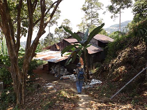
The path now dropped down to a substantial house, at least here someone had discovered that geese do a better job than dogs.
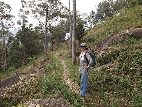
It was now just a question of following the path along the contours, the Areca palms made for an unusual hedge. The electricity poles were a sure sign we were heading back to the main road and for the last part we were on a concrete road as we approached the key junction at the summit of the Bailk Pulau to Air Itam Road.
With the benefit of the early start, we had plenty of time in hand, it was just 13.00. Yuehong had got her energy back, it's probably the least interesting part of the walk with the well signposted wide concrete road.
I've included the first picture as a reminder that at pole 21, a long path goes off right towards Titi Kerawang or Tiger Hill. When we got to the next junction, Yuehong mischievously asked if we had tried the turning to the left before, I had to admit we had not. I knew what was coming next, we had been to that bloody temple ahead at least three times this year already. Oh dear, that meant I would have to start using my brain and worse still postpone my second Tiger moment.
So off we went down what was not a bad path. At the first house, the owners were nowhere to be seen but their obnoxious dogs were, fortunately most were chained up.
The path continued to a small hut above 'The Triangle' which we had seen from the other side. I wheeled out my rusty Indonesian to see if the occupants knew of a route that would take us across to the next ridge below the 'Temple with the View', they did not. So down we went.
At the bottom we came to some very young rubber and followed the top terrace right. We could see a trail coming up which we eventually joined. In fact we could have come straight down from the hut although that route was not in good condition. It was a good concrete path, someone spotted a house below and said 'Easy La!'.
I had to break it to Yuehong that last time we visited that house (with the Sacred Heart lady), it had taken some considerable time to extract ourselves as the streambed beyond was impenetrable and the cleared rocky open area below it unpleasant in the extreme. So I refused to consider bashing right and insisted we carry on down to where the good lady had said there was a path from a hut. She was quite right, opposite where we briefly joined her road we could go down. For the record, the pole reads NH 2 9 23.
This was entirely new territory for us, the path zig-zagged down invitingly and then came to an abrupt end. We back tracked a little and found a small trail down. It wasn't particularly good but very soon we could see the end of a concrete path below us.
That would surely take us out comfortably and it was time to relax before heading out. I finished my sandwiches and the contents of Yuehong's cool bag. It was barely 14.00.
It turned out to be one of those well maintained durian estates with concrete paths everywhere. We could have gone straight down, but I still had a hankering to traverse to the right. At one U bend, we found we could readily reach the next estate along.
However, we were directed downwards and joined a concrete road.
Next to the road was an attractive wooden house and unusually the road finished 50 metres short of another road which presumably we would have come down if we had kept going a little while earlier.
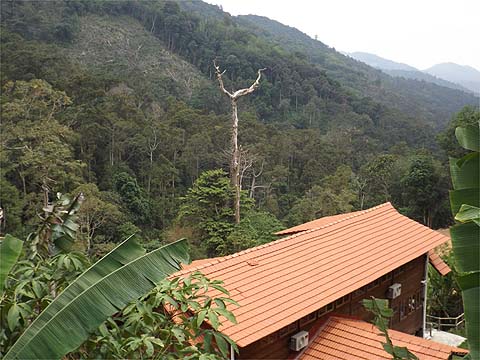
This part was clearly developed long ago when people had taste as well as money. At the first of the new houses, the omens are not good, the trees appear to have gone and for the time being bananas reign. The next set of houses have plastic covered fences around them and land that has been almost completely cleared. One of them - I wouldn't defile my pages by including a picture - is the large Appamadavihari Meditation Centre, where people no doubt delude themselves that they are achieving Nirvana, never mind that first someone needed to create hell on earth. We suspect that the tree is actually long dead but it does symbolise these owners' attitude to nature.
By now it was 15.00 and we faced the trudge down the valley to Balik Pulau. Fortunately, just over half way the good Samaritan on the motor bike turned up again and whisked us to the Hometown Food Centre for an internet session and refreshment. This was a great day out, thanks to Yuehong's insistence we had found a completely new route down and there are more paths in this area to explore, although it will have to wait for our next visit as we are off back to the UK at the end of March.
|