|
Penang Hills and Trails - Penang's Secret
Valley |
|||||||||||||||||||||||||||||||||||
|
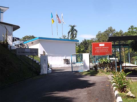
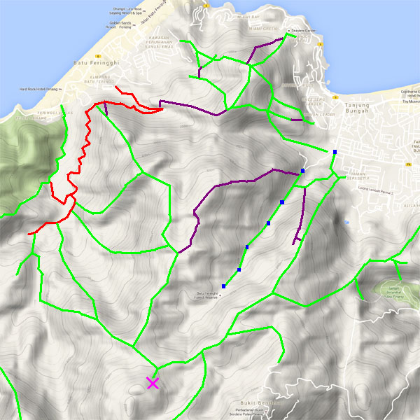
This is one of a series of pages on walking the hills of Penang, click here for the index. This is a Grade 3 walk. There is a sketch map at the bottom showing the route followed. Click here for a list of the known PBA rain gauges. Please visit my Penang buses page for information on accessing the starting point. This path is in a restricted area controlled by the PBA. Walkers may be challenged by PBA staff and you use it at your own risk. I would advise going at weekends and public holidays when there will be recreational walkers on the access road and there will be fewer staff around. If you look at a map showing the topography of the north coast of Penang, you will see that there is a long narrow valley running inland from the south-west corner of Tanjung Bunga. On both sides it has high ridges and its far end is closed off by Western Hill. Along it runs the Sungai Kelian and you'll be hard pushed to find any reference to it on the web. The main reason for this is that it is a restricted PBA catchment area, a secondary reason is that there is known path out. The walk starts at the PBA base at the corner of Jalan Lembah Permai. There's no problem to pass the barrier on the left as the road is used by recreational hikers. Maps show the road completing a loop but that is now closed off, access finishes at the Guillemard filtration plant. The whole complex was built at the same time as the Fettes aqueducts hence the similarity in building style, behind is a seriously interesting hill, Bukit Batu Ferringhi, probably the highest one in Penang for which there is no known path to access it.
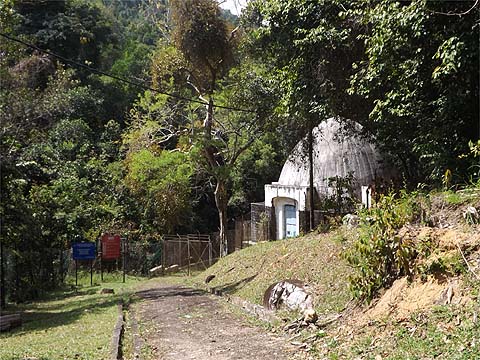
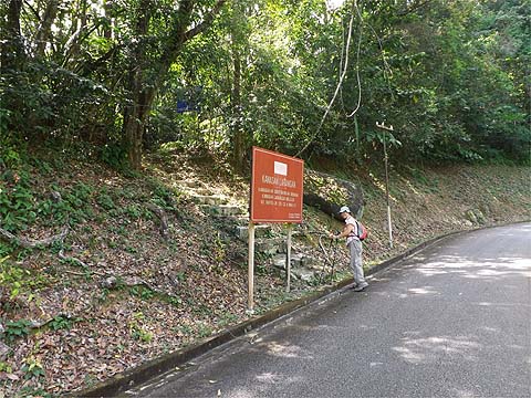
However, today we didn't need to go that far. On the left is another of the delightful 'art deco' buildings and just after it a set of steps and a standard red sign which always shows where there is something interesting lurking behind it. Just before this point a man on a motorbike came past, stopped and asked "Are you going up?" and, of course, the answer had to be "No".
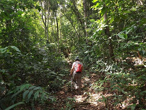
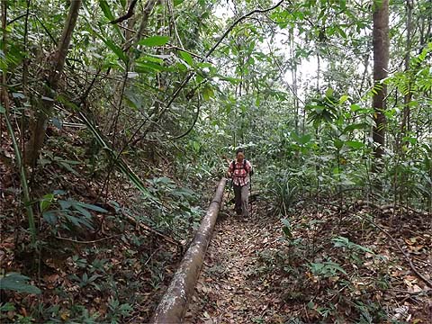
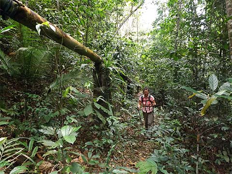
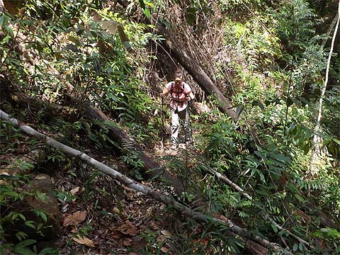
We made sure no one was watching, climbed the steps and for the next hour and a half or so enjoyed a steady climb through what to some might look like jungle but is actually ancient rubber terraces for the most part. Whatever the case, it made for good hiking on what would have been a very warm day in the sun.
The path runs some distance above the valley floor which is littered with huge boulders. Across to the other side we could see Bukit Lang which we had climbed a few days earlier. After a while, the path was joined by a pipeline which had presumably come from the filtration plant.
We would follow it to its conclusion, hash paper was almost absent here but since there are no junctions it would have been superfluous.
At one point the pipeline ran some way above us and when we rejoined it we could hear a strange noise which turned out to be a leaking valve. Almost certainly this is where I picked up an unwanted passenger, my first leach for several years, which only revealed itself when I removed my jeans some hours later...
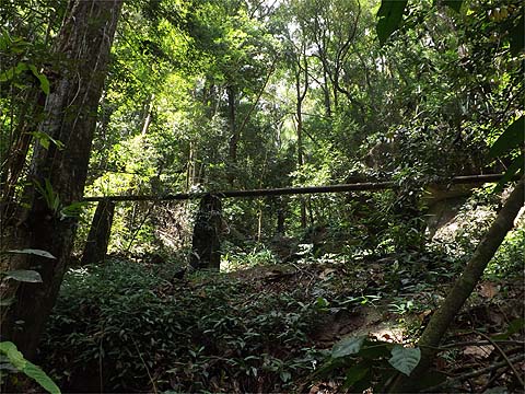
Nearer the end, the trail got more interesting. There was a tree to duck under and bridges (metal and concrete) and a section where the path will shortly vanish into the gorge some way below.
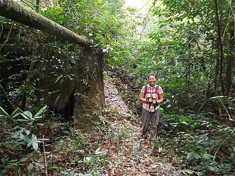
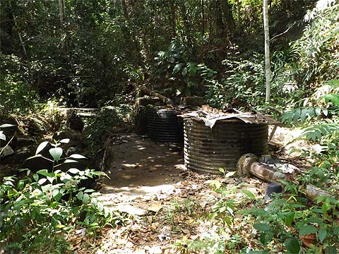
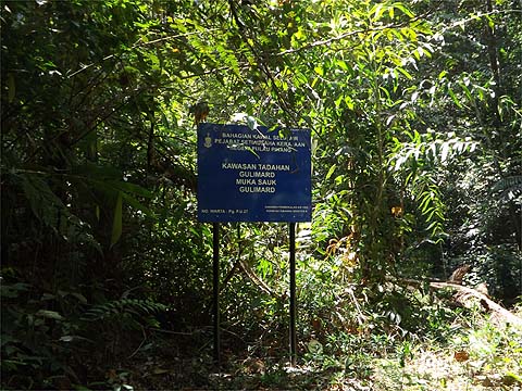
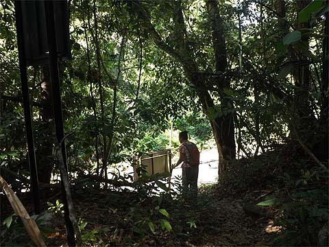
The water tanks indicated we were close to the end. My map shows several streams joining here and there was one pipe starting across a narrow rail. A trail led up to our final destination, Yuehong was on her third hike in as many days and was still going well. Here we found a brand new blue sign, which went a long way to explaining why this PBA path had shown rare indications of recent maintenance; it must have been necessary to bring up this delightful piece of misinformation whereby Guillemard had become 'Gulimard'. In this respect it was granted a tie with another such notice we saw later which had represented 'Kelian' as 'Klean'. Obviously the literacy requirements for PBA employment are not very great.
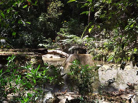
Beyond was a small dam and the Sungai Kelian in its prime.
We took a refreshment break and headed back down, there was no temptation to look for a route out of here although Peter van der Lans has gone up the terraces to the left and eventually joined the path from the Botanical Gardens to Western Hill near rain gauge 9. On a historical note, this pipeline seems to have predated the Fettes Aqueduct by some years. I have tried to identify the "R M & C" carried but without success, the 'C' is not 'Co'.
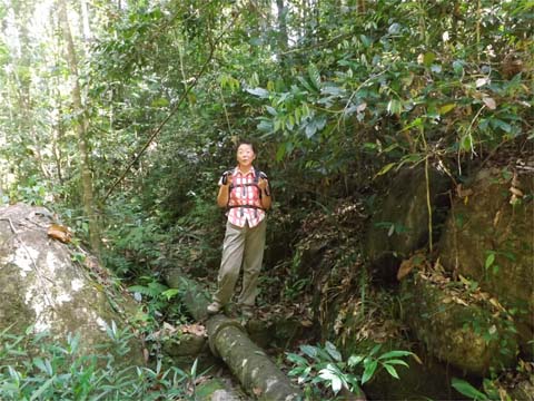
Yuehong posed to show here balance and we passed a solitary piece of repugnant DAPpery which must have blown over from the Haunted House.
We went back across the metal bridge and I was left wondering what the attachment was for, I wondered if it was to stop the pipe buckling at the joint.
One more ladylike pose at a water stop and we were back ou.
It was a very enjoyable afternoon out, with our various commitments it made more sense to do this kind of shorter walk than further blockbusters. We had been out to a 'Hakka makan' in the hills the previous day and had another similar one the next day, both would involved undemanding walks. At that point we shall have the use of a car which will allow us further explorations in the far south of the island. Most people pity us for having to walk up the access road to where we live as they race past in their cars. Of course, that means not only are they less fit than we are, they also miss out on sights like our local troupe of dusky leaf monkeys parading on a branch high above the road.
|