|
Penang Hills and Trails - The Balik Pulau
Explorer 1 |
|||||||||||||||||||||||||||||||||||||||
|
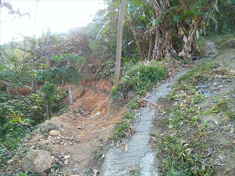
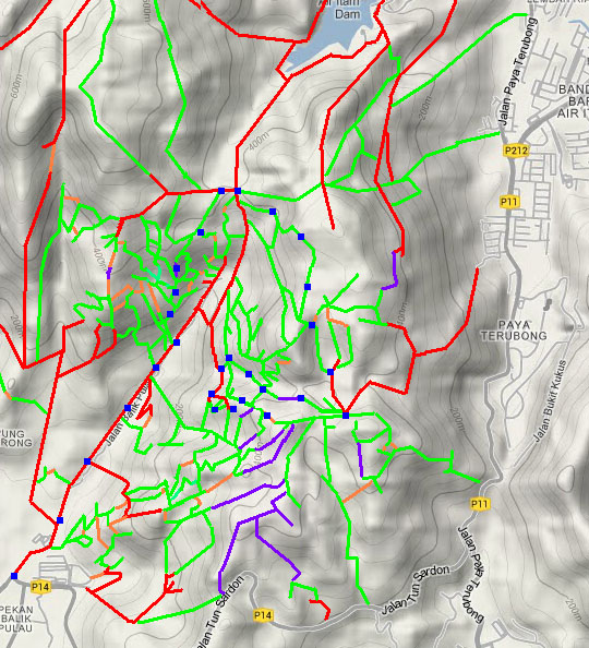
This is one of a series of pages on walking the hills of Penang, click here for the index. This is a Grade 3 walk owing to its length and two 'off piste' sections. There is a sketch map at the bottom showing the route followed. Please visit my Penang buses page for information on accessing the starting point. With effect from 2022, if you follow this route down, then near the bottom you will find you are on a new concrete road. While the path ahead down to the right is still present in part, it is not easy to find a route out. Instead you will need to follow the road down. A description of this alternative route is given on another page - the link will open in a new tab. As of January 2023. the key section below Nanshan which connects to the Balik Pulau valley appeared totally overgrown. Attempt to use it entirely at your own risk. We have spent several days testing the paths on the east side above the Balik Pulau to Air Itam road, this is the first report, the others can be accessed by the index to this area. There are side 4 ridges running out from the main ridge between Anjung Indah and Bukit Penara, in future I shall refer to them by their numbers. Strictly there are 3 and the first one splits into two. Hence the Nibbinda Ridge is Ridge 1 and so on. The first half of today's walk was towards Ridge 3. Unlike many of the other reports, this is NOT a suggested walk, rather it contains information which will help other people like us who want to explore and understand the system of paths around Balik Pulau. Basically, having gathered all the low hanging fruit, we now have to look for possibilities to join dead ends without going excessive distances through unpleasant terrain. In this respect there is plenty of scope in the valleys behind Balik Pulau and our progress this year is reflected in the development of the sketch map at the bottom of the account. On this occasion we hitched a ride to the airport with our departing visitors and having seen them off, we took an early 401 to Balik Pulau where we enjoyed breakfast in the dark, it was not yet 07.00.
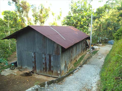
As soon as it was sufficiently light we walked up the Air Itam road and branched off right up the concrete road below Forest Ang's Trail. We went beyond where we had been previously and found the road continued to climb to the south. Eventually we came to a Y junction and chose to investigate the right (lower fork) first. Very soon it finished (left picture below) and we took the upper concrete trail. The lower trail we left for another day. There was obviously a house above us, so at the next fork we took the right fork (right picture below).
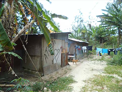
We could hear dogs above us and soon we came to another junction, looking back we came from the left and this is clearly an extension of the concrete road we had ignored earlier. We carried on and the road finished just beyond the vine with its orange coloured 'fruit'.
Straight ahead at the junction was a house with more yapping doge. We looked up the hill to the left but soon found all the branches to the trail got rapidly overgrown in the fruit orchard, they were obviously 'seasonal'. However, going down was another path, which will be worth checking another time. It might curve back to the concrete road (that looks like a path to the right), it might go up the valley or it might lead to the hill opposite which similarly has fruit and rubber. We had almost certainly come down the far side of this valley from Nanshan a long time ago, but that was another 'not to be voluntarily repeated' occasion.
We hadn't really expected much more and back we went taking the concrete road which climbed up to a small ridge with a multiple junction. We could see where the concrete road would go back to where it had split off from us and there was a path up the hill which looked interesting. It was time to conserve Yuehong's energy and I went up alone. At first I took the concreted path left but that went up for a few minutes and ended in a vegetable garden.
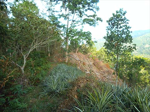
The sandy path right went much higher and there was a line of electricity poles which led to a vegetable garden where maybe someone had once planned a house. On the way up there was a path off left and then another being developed although currently it goes only to the bottom of a recently cleared area. At the top of the climb there was old rubber to the right and a small pineapple plantation with more rubber beyond (this is the view looking back down)
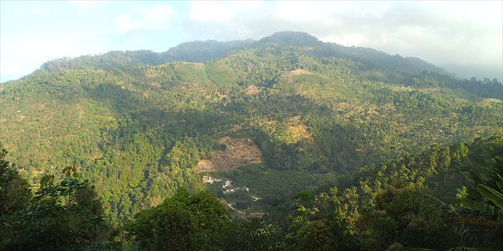
There was clearly trails running on through the rubber but there was no time now to check them out, I had been gone quite long. This was the top part of the rubber above Forest Ang's Trail which we would follow later. The rubber on this ridge clearly didn't go as far as the main ridge at Nanshan, there would be a few hundreds of metres of rougher stuff to pass through, I'll discover later whether there is a trail or something similar (or not). (Indeed it is perfectly feasible to continue from here to Nanshan, click here for the description.) Going back down, I was treated to a splendid early morning view of Bukit Elvira and the 'Temple with the View'. It's moments like this that make climbs like this which are 'failures' worth making the effort.
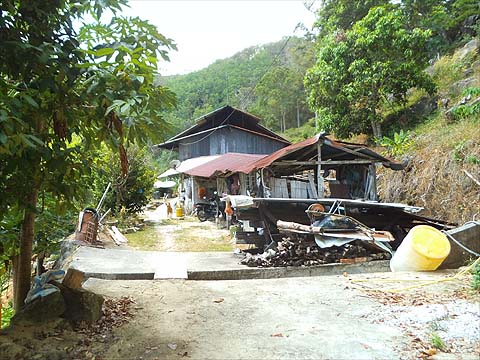
Back at the junction, Yuehong was more than ready to go. The fact that the concrete path out had electricity poles told me exactly where we would come out, namely at the bottom of the Forest Ang Trail. Indeed, very soon we came to this house and just beyond it was the path left back down to the concrete road.
With an early start, I had deliberately chosen a west facing hill so we could do the exploring out of the sun. However, by now it was almost 10.00 and having turned up the valley towards Nanshan we had our first sunshine and the sun glasses were on. It was time for another exploration. Just after the hut below, a path goes to the right up the hill; it's clearly being worked on.
Again I left Yuehong and went up it, zig-zagging until I was once again on the original decayed path. It was clear it was not going into the rubber on the left and when I got to the point where I could see what I assumed was the cleared area I had seen before, I went back. I have marked it as joining the path up I used earlier but that is a calculated risk!
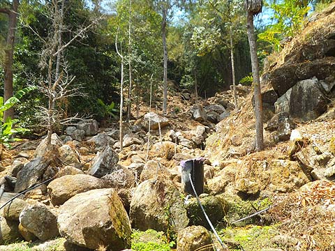
We went to the end of the path and Yuehong marched on up what was an adequate path. Bearing right we got round the wall of rocks and then followed the water pipes until they joined the stream. At this point we kept left through the ginger where is a grey coloured pipe before emerging at 'the rocks'. Now there may have been a path to the left again once but these days, the stream offers the better option. In fact there are inaccessible bananas on the south side but I knew things were alright when Yuehong said "I can see the big bamboo" and then there was a last short scramble and we were in the durian orchard and it was time for my first refreshment stop of the day. The exploring was over for the time being.
We went up to the 6 way junction at Nanshan and over the hill to the cross roads at the top of the Balik Pulau to Air Itam road. I had long wanted to check out this path and today was the perfect opportunity. I'm not sure Yuehong thought it such a good idea, especially when it evaporated at this house after 1km or so. "There is no road down" I was told in Indonesian and back we went.
As it happens, there is another turning not far up the road to the 'Temple with the View' so we tried that too. You can tell from the body language that Yuehong was still unimpressed. "Look at the view" got no response.
The road wound on, it was the kind of hiking Yuehong likes best, the road (right) was clearly about to end at a house so we took the path left and Yuehong was looking almost happy again.
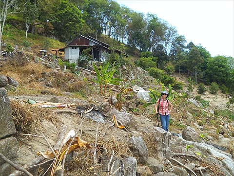
Unfortunately, round the final corner we went and while we could see rubber beyond, this path clearly finished at the house. Being the second day of Chinese New Year, there were visitors but a lady appeared who spoke excellent 'Balik Pulau Sacred Heart' English. What about the possibility of getting to the rubber where we could see a path? Very difficult was the verdict, as there was a boulder strewn stream in between. Now I really didn't want to go all the way back up again and the promised land was just a couple of hundred metres away so I checked the contour following option but there was greenery covering the uneven terrain, not a good idea at all. (Please note that as of December 2015, there is a completely new zig-zag road down before the house, we weren't blind, it didn't exist when this was written in February 2015).
So we picked our way down although I felt it wiser to keep the camera out of sight. Finally, I allowed myself to get a little ahead so I could establish the best way down and out. It doesn't look far, the drop was probably not even 20 metres but that wasn't the point of course...
After which it got a little steeper. That wasn't a thumb but a finger being waved at me although by the time she realised that worst was over Yuehong had perked up.
However, it turned out that the other side was a bit rougher than expected so we had to continue down the stream, there's a red dot in there somewhere. Yuehong's knee was complaining to her and she was complaining to me. Long experience has taught me to let the volcano blow itself out and in due course she appeared on 'terra firma'. It had taken just 20 minutes to reach the streambed but equally long afterwards.
The known landmark was a mixed blessing, it was the famous 'dogs and chickens' establishment which we normally try to avoid. However, from the noise and the number of motorbikes present, the occupiers were entertaining on a grand scale and the dogs had all been banished or locked up. It would have been even better to think they had been barbecued for the occasion.
I got a constant earful about my thoughtlessness all the way down to the main road but when we hit the flat bit, it turned out the knee wasn't permanently damaged. When we got back to Balik Pulau and found the large coffee shop open and airy, Yuehong's condition was diagnosed as 'hunger' and as all that was on offer was a Char Koay Teow' that was the answer..
So much so that I was allowed the luxury of a second Tiger and we easily passed the time before the 17.30 501 to Teluk Bahang and onwards home. Yes, it had been a long day, but we weren't as tired as the previous outing as we'd never been in a hurry. Basically, the morning breakfast hadn't provided enough carbohydrate for when it was needed and it being Chinese New Year there had been no buns for the mid-hike snack.
|