|
Penang Hills and Trails - Malihom from the South
West |
|||||||||||||||||||||||||||||||||||||||||||||
|
This is one of a series of pages on walking the hills of Penang, click here for the index. This is a medium length Grade 3 walk with significant less straightforward sections. There is a sketch map at the bottom showing the route followed. Please visit my Penang buses page for information on accessing the starting point. This account is linked from my Penang Peaks page which lists peaks over 400 metres as well as other places of interest and viewpoints. To find other hikes which visit this peak please check the maps of this area using this link. Recently we completed a hike from the Indian temple, known as Vellaipala Arulmigu Sri Muneeswarar Devasthanam on the Teluk Kumbar to Bukit Genting road which went up the hill next to Malihom. The main climb was from the col at the west end of the Sungai Ara valley. At the time, I hadn't considered climbing the long ridge to it from the road but we have now done just this. Despite my concerns that it would be long and tricky, in practice it was easier to accomplish than the first hike. We parked up below the temple which is on a section of the old road now bypassed by a new viaduct - it would be shady on our return. We walked back to where the path starts immediately to the right of the temple.
We'd attended a temple feast in the Sungai Ara valley a couple of days before and Yuehong had gone ahead from here to bag a couple of seats while I checked out the path to the left. My intention had been to maybe find some more rubber rollers but it hadn't worked out that way. I'd expected to spend just a few minutes but it took the best part of an hour as I got lured by unexpected paths. First though, it goes some way up through the orchard.
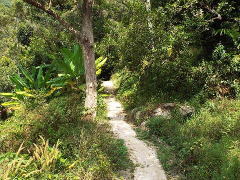
It then enters old rubber and it's rather surprising that the path is in such good condition because there doesn't seem any reason for anyone to come up this way regularly.
It finishes at a small ridge and on the other side is an orchard.
As often seems to happen, there's an adjacent concrete path which I had followed up to its conclusion. I'd also followed it down to where it joined a concrete road. Despite going slightly down to the left, this was almost the end of it where there's a house. So we turned right...
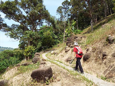
There was a very gentle climb to the 'summit' where we found this Chinese gentleman I had met previously. This time Yuehong engaged him in conversation. Now most farmers would have said words to the effect that "we wouldn't want to go up his path because it leads nowhere". However, he was most encouraging, it would go up for over a kilometre and there would be a nice view of the sea at the top.
The road down would obviously have been an alternative approach, but the benefit of our chosen route today was that it avoided an unpleasant walk along the main road below. The path ran upwards from just beside the house.
It was immediately apparent that it was a 'classic'. My original thought had been to access the main ridge as soon as possible, as you can see it was not too far away above us on the left. However, the path was excellent and it was both gaining height and heading in the right direction as it zig zagged.
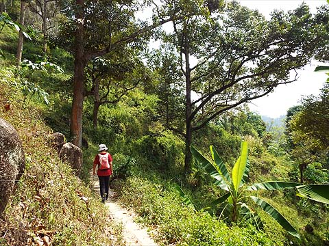
At one point we were very close to it and could see it was covered in rubber, the owner obviously went to the same 'durian school' that I went to and believes they don't prosper in such place as the well spaced trees are vulnerable to high winds. The rubber trees at the top appeared quite young while these just above the durian limit were 'mature'.
The path continued horizontally through some ginger and when we emerged, the ridge was rather higher and so we were back in the durians.
When we came to the only junction, we first looked at the lower path although we doubted it would be useful. Indeed, it went only a short way to a couple of shelters and then finished.
Back we went and continued the climb.
Looking down we could see we were well above the new flats in Teluk Kumbar and the sea, as promised, was in the background. At this point, there was nothing cultivated above us.
Finally we came to an area which was being cleared for replanting, it would have been very old rubber but there was a clear route through it even though the concrete had finished.
We had to go down slightly but we then found a clear route up to the ridge just above us.
Were we to come back in the opposite direction, it would be easy to go down here, but it would be most important to turn right as soon as possible because below is very steep and it would be a long way to a good path. Once on the ridge, we knew exactly what to expect.
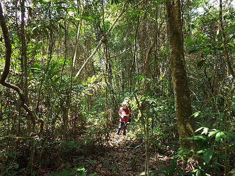
The first few yards are always overgrown but beyond much of the 'forest' (very old rubber here) was quite open.
There was a trail of sorts and we made good progress on what was never more than a very gentle climb.
This was the end of one diversion and then we hit a rather overgrown section where patience and snipping were needed in equal amounts. The camera threw a 'wobbly' which was only cured by a change of batteries and a 'system reset'. After I sorted that one, I said to Yuehong "We'll meet the three large rubber trees shortly." and that's exactly what happened, we had just passed the point where we had come up from the right recently although there was no obvious landmark.
I had forgotten that the trail for the next part was less than clear but we soon reached the tree I had photographed before and that meant we were just above our resting point at the top of the next orchard where we could relax for 20 minutes.
I now put the camera away as we were to follow exactly the same route back as on our previous visit to this point. if you need to check it then, click this link. With the sun well off its peak and a nice breeze from the west, conditions were very pleasant and we enjoyed a gentle walk with the final orchard looking very attractive.
This was walk #91 for the 'season' and in parallel I've started 'collecting' old rubber rollers which we see abandoned, usually 'in situ' in the south of the island. One way and another, that total has been creeping up and had now reached #85, one I had not expected to improve on with this walk. However, on our way to dinner a chance meeting bumped that total up to #89 and it seems that we now have a race to the magic 'ton'. Conventional wisdom had been that the hill we had visited twice would be hard work if not almost impossible and it had turned out to be as accessible as all the southern peaks. Next up it was time to explore the area to the immediate south and climb to the bird's nest factory near the Bukit Papan summit, which we did a couple of days later.
|